Type: Out-and-back
Distance: 4 miles
Difficulty: Moderate
Hike time: 2 hours
Traffic level: Medium
Drive time from downtown: 20 minutes
Dog-friendly: Yes
Rating: 4/5 stars
The Cumberland Trail offers 210 miles (and counting!) of open trails throughout Tennessee. There are several unique sections to explore on day hikes or backpacking trips, including the North Suck Creek Gorge. Located on the eastern edge of Prentice Cooper State Forest, this section of the Cumberland Trail includes an established camping area along North Suck Creek. Hikers may enjoy a 3.8-mile day hike to Mushroom Rock or extend their adventure to an overnight stay.
The trail to Mushroom Rock begins on Suck Creek Road just past the boundary to Prentice Cooper State Forest, approximately 2.3 miles north of the river. There is no designated parking, so you will likely need to park in the pull-off about 0.3 miles past the trailhead and walk down the road for trail access. If your vehicle has four-wheel drive, you may also park closer to the trailhead off the southbound side of Suck Creek Road.
The trail starts by crossing South Suck Creek and climbing 350 feet in the first 0.4 miles. This initial uphill push will definitely get your heart rate up, but the trail levels out around 0.6 miles and remains fairly flat for a ways. Keep an eye out on the left-hand side of the trail for an interesting sinkhole and underground rock formation.
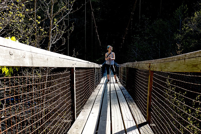
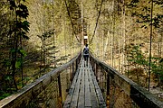
Around 0.9 miles, the trail begins a steady drop toward North Suck Creek, losing 400 feet of elevation over half a mile. A beautiful suspension bridge lies at the bottom of the descent, spanning 225 feet over the creek. Across the bridge there is a large picnic and camping area with plenty of level space for tent camping. For backcountry camping reservations, check out the Friends of the Cumberland Trail website.
To reach Mushroom Rock, continue following the white trail markers. The trail begins to climb again near 1.6 miles, utilizing three switchbacks to climb 300 feet. The trail levels out after the third switchback, and Mushroom Rock should be visible ahead. Standing 20 feet tall, this sandstone pedestal is a fascinating structure to behold. It sits atop a small bluff, offering a nice picnic area before heading back toward the trailhead.
Since this day hike is an out-and-back trip, you have to tackle the elevation change again in reverse order. I recommend bringing trekking poles and wearing sturdy hiking shoes to keep your knees happy.
Although the elevation changes at consistent intervals, this trail is a great moderate challenge for hikers of all levels. As you climb or descend a steep section, it is encouraging to know there is a level section ahead where you can catch your breath.
Since the trail is heavily wooded, there is also a variety of wildflowers, ferns and trees to hold your attention throughout the hike. I certainly look forward to visiting Mushroom Rock again.
 Bryant and Elise Hawkins
In late December, Bryant and Elise Hawkins, recent Chattanooga transplants, kicked off a yearlong hiking project. Every week, they choose a different trail, varying in length and difficultly and located within one hour of Chattanooga, to hike and review.
Bryant is a photojournalist whose work has appeared in The New York Times and the Los Angeles Times, among other places. Elise is currently working on a Master of Education at the University of Tennessee at Chattanooga. Together, the outdoor enthusiasts hope to discover the region's endless outdoor opportunities.
You can follow the Hawkinses' hiking adventures by "liking" Get Out Chattanooga on Facebook, where we share their write-ups every Friday.
Have a trail suggestion for the Hawkinses? Email them at info@bryanthawkins.com.